HIKING · CYCLING · TRAIL RUNNING · CAPE PENINSULA
Hiking, Cycling & Trail Running
From fynbos trails in Silvermine Reserve to the legendary Chapman's Peak Drive — 9 routes for active explorers.
The Cape Peninsula is a paradise for hikers and cyclists. From coastal trails along Chapman's Peak to fynbos-covered mountain paths and relaxed cycling through vineyards — the landscape offers routes for every fitness level.
Hikes — From Fynbos Paths to the Cape of Good Hope
Most spectacular hiking trails in the world — right on your doorstep
Silvermine Nature Reserve — Noordhoek
The Silvermine Nature Reserve sits right behind Noordhoek and offers numerous trails through indigenous fynbos with spectacular views of both oceans. The Silvermine Reservoir Walk (3 km, easy) is perfect for families, while the Elephant's Eye Cave Trail (6 km, moderate) delivers one of the Peninsula’s best viewpoints.
💡 The Elephant's Eye Trail starts on Ou Kaapse Weg and rewards you with a cave-framed view across False Bay all the way to Cape Agulhas.
Cape Point & Cape of Good Hope Trail
Africa’s south‑western tip delivers some of the world’s most dramatic coastal hikes. From the car park to the old lighthouse (3 km, moderate), along the cliffs to the Cape of Good Hope (6 km, challenging) or the full circular trail (14 km, full day). Ostriches, baboons, zebra and antelope along the way.
💡 Start early. Take the Flying Dutchman funicular up and hike back down. Important: Do not feed baboons — keep your car locked!
Pipe Track — Camps Bay / Twelve Apostles
The Pipe Track follows a historic water pipeline along the Twelve Apostles above Camps Bay — with some of the Cape’s most spectacular ocean views. The path is wide, mostly flat and easy, perfect for a late‑afternoon stroll with sundowner vistas. At the end you reach Kasteelspoort gorge, from where you can ascend Table Mountain.
Lion's Head Sunset Hike
Climbing Lion’s Head at sunset is a Cape Town ritual: on full-moon nights hundreds ascend the distinctive peak to watch the sun sink over the Atlantic and the moon rise over False Bay. The route is steep in places with ladders and chains, but the 360° summit panorama is unforgettable.
💡 Magical on full-moon nights — bring a headlamp for the descent. Start about 2 hours before sunset.
Table Mountain — Platteklip Gorge
The most direct route up Table Mountain: Platteklip Gorge is steep, strenuous and spectacular. Climb 700 vertical metres through a ravine to the summit plateau — where one of the world’s great panoramas awaits. Option: hike up and take the cableway down.
Cycling — Coastal Roads and Vineyards
From Chapman's Peak to the vineyards of Constantia
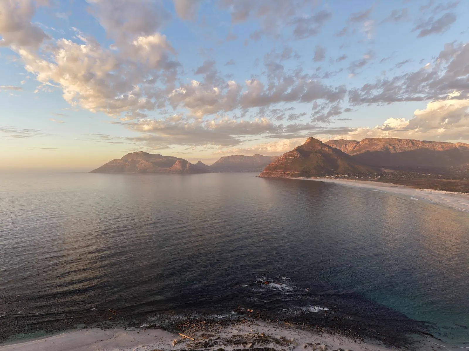
Chapman's Peak Drive — Hout Bay to Noordhoek
Chapman’s Peak Drive is one of the most spectacular coastal roads on earth — even more impressive by bike than by car. The route from Kommetjie via Noordhoek, Chapman’s Peak and Hout Bay back home serves up soaring cliffs, hidden coves and every shade of Atlantic blue.
💡 Set off early (before 7am) — the road is virtually car‑free and the light is perfect. Sundays are especially popular with road cyclists.
Constantia Winelands loop
A relaxed ride through the Constantia Winelands — South Africa’s oldest wine region. The loop links Groot Constantia (1685), Steenberg, Buitenverwachting and Beau Constantia. Between estates you’ll find shaded avenues and historic Cape Dutch architecture. Ideal on e‑bikes.
False Bay coastal ride — Muizenberg to Simon's Town
The seafront from Muizenberg via St James and Kalk Bay to Simon’s Town is one of the Cape’s prettiest bike routes — flat, safe and with constant ocean views. Along the way: Muizenberg’s colorful beach huts, Kalk Bay’s photogenic harbour and the penguins at Boulders Beach.
Trail Running — Fynbos, Single Tracks & Ocean Views
Trails for every level
Noordhoek Common & Wetlands
The Noordhoek Common is an extensive wetland with a network of flat sandy paths and boardwalks — perfect for easy runs with birdwatching. Herons, ibises and, with luck, flamingos will be your companions.
Long Beach Run — Kommetjie
Eight kilometres of firm sand right at the water’s edge — from Kommetjie to Noordhoek or the other way round. One of the world’s most beautiful beach runs: waves on one side, Chapman’s Peak on the other, and often no one but you, the gulls and the odd surfer.